We did this walk up on to Skye’s highest clifftop, by what I’ve called ‘The Peat Bog Way’ , on one of the most awful trackless routes I’ve experienced anywhere! Not to be recommended though once you get out onto the short cropped grass beside the 1,000 foot cliffs, it’s a delight.And spectacular.

We set off, Chris and his brother Robbie and I on an overcast day which came good (as they often do) and parked on the high single track road near the radio masts.It’s accessed just before the road drops down to Glendale on route to Neist Point.
It’s not the most obvious route to this highest cliff point on Skye but Chris, perusing the OS map the night before, reckoned it would provide us with a lovely high level ridge walk as we headed out to Dunvegan Head itself. It didn’t!!
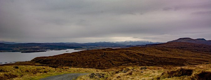
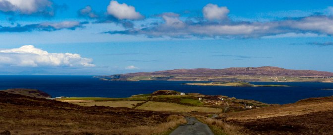
It started off ok, on a proper road up to the radio masts. Nice views over to Waterstein Head and the crofts beyond Glendale.And back towards the Black Cuillin.


But then our ‘route’disappeared amongst incredibly rough ground. I think divorce would have been on the cards if Robbie hadn’t been there to keep my gas at a peep; we plunged in and out of peat bogs, balancing precariously on peat hags above black, smelly slimy bog for the first hour of the ‘walk.’ I could have wept when I looked back and saw the little distance we were from the radio masts after 60 minutes of zig zagging to avoid the worst ground.Who’s bloody idea was this?? My beady eye, becoming an evil eye, was fixed on my stoical husband as he led us across the wastes. Silence descended on us all as we realised this was no fun at all but more a matter of not coming to grief!
We were headed for a small hill which I hoped would give us the views we were hoping for but as we crested the first one all we saw was another hill ahead. There were three of these false summits which blocked the view of our final and still distant destination -Dunvegan Head itself. Relief beyond belief when we finally crested the third minor hill of this route and got a view out to our objective – which was still miles away. But at least we could now see the best route, getting ourselves off this awful ground and down to the emerald grass that lined the cliff edge.It would also be great to be down above the ocean rather than stuck up here, miles away.

Down, down we clambered through steep heather until we reached the delightful flattish cliff side.Spirits rose and we had – now – a good laugh about it all. Even better, the sun had come out to celebrate the fact that none of us had broken a limb on the horrendous trudge to this point and our leader had not been assassinated.
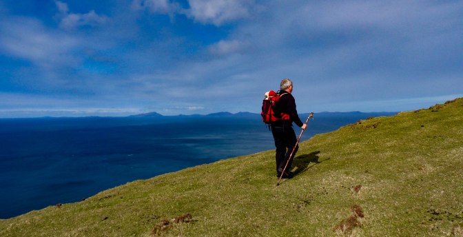
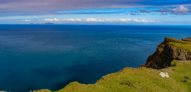
It was now only half an hour or so to the top but the whole walk had taken us abut 2.5 hours – when the normal route must be an hour at most.Never mind, those cliff views across the deep blue Atlantic were superb.There were many ‘geos ‘- or clefts – in the cliff edge giving us dizzy views downwards every so often.

The Outer Hebrides sat like jewels of deepest indigo on the horizon……


…..and all was well with the world as we reached the trig point.

There is a little ledge of grass built up there and we lay down and looked – carefully – over the edge.The cliffs falls sheer for a thousand feet, a giddy sight but mesmerising.
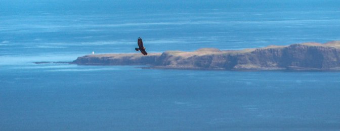
And just to make the day, on the summit we watched a golden eagle for around 15 minutes as it hunted across the moorland and soared above the ocean,then swept several times over our heads as it checked out who the 3 interlopers were in its territory.Absolutely magnificent sight, a real thrill.

Views out to Waternish and – just – the cloudy Black Cuillin, capped it all.We descended via the more usual route, a semi track which led in about an hour to the tiny hamlet of Galtrigill, with another 1.5 miles or so on tarmac back (and uphill, groan) to our car.
That descent track was not without its minor traumas also as the ground is rough and boggy near the hamlet itself and heavily fenced and walled.Plenty clambering over and through these obstacles as there seemed to be few gates.

Who says Skye is too busy?! We met three people as we descended and not another soul at the summit ( and of course, no-one else daft enough to take our approach route over the high moorland.Not surprised we had that one to ourselves 😦
For other walks on Skye see MY FAVOURITE SKYE WALKS

One thought on “THE GOLDEN EAGLE OF DUNVEGAN HEAD”